Laurel’s Compass Travel Blog

A travel writer’s guide to adventures of sustainability and spirit

Cold Weather & Warm Memories at Canada’s Lake Louise

We sat at the center window of the Lakeview Lounge at Chateau Lake Louise. Photo courtesy Fairmont Chateau Lake Louise

Originally posted  in January 2015


It was a triple-treat kind of day in the Canadian Rockies. Feeling like royalty, my husband and I dined on an early lunch at the Fairmont Chateau Lake Louise’s Lakeview Lounge, where we were seated at the picture-window table overlooking one of the most beautiful views on the planet. On the other side of the glass, steep mountains plunged into iced-over Lake Louise. The pines were flocked in white; a light fell like whispers over the scene.

Iconic landscape, iconic hotel, iconic window-seat on nature’s spectacle. We drank it all in.

Though it was barely 15 degrees outside, we lapped up epic beauty while slurping spoonfuls of steaming, roasted butternut-squash soup and biting into a savory pulled-pork barbecue sandwich (me) and veggie quiche (Ken).

It was difficult to know what to focus on: tasty lunch or the view—especially for Ken, who had just returned from a brisk nordic ski through the surrounding woods. We xclaimed over the cuisine, then next marveled over the wintry wonderland outside. All the while, we could hardly believe we werestaying at the Chateau, a luxury Fairmont property located in Banff National Park.

The Fairmont Chateau perches on Lake Louise, a UNESCO World Heritage Site located within Banff National Park. Photo courtesy Fairmont Chateau Lake Louise

We ask the waitress to take our picture; she snaps one, and then the camera battery goes dead. Ken and I have only scant photographic evidence of our good fortune, but the majority of our memories from this lunch-to-remember will be preserved on our human memory cards forever.

He Skis; She Doesn’t

Our trip to the Canadian Rocky Mountains in winter is a consolation trip in replacement for a June birthday vacation that was canceled because of my urgent hip surgery. What we needed was a wintertime getaway that allowed Ken to ski while I enjoyed the scenery from a non-slippery vantage point. We couldn’t have chosen a better locale than Lake Louise: for sunrise-to-sunset views of this UNESCO World Heritage Site, there’s no better place to stay than the historic Fairmont Chateau Lake Louise.

(We chose to stay in a less-pricey forest-view room. Although our bedroom window didn’t overlook the lake, we watched the sun set on the snow-covered peaks and the full moon rise behind them without leaving the comfort of our well-appointed accommodations. The room was small, but well laid out so that we weren’t tripping over each other. And having a tea kettle and coffeemaker was convenient too.)

In the hotel’s posh indoors, we rubbed elbows with well-heeled folks on ski holiday, attendees of a spectrometry conference, and Olympic skiers (our trip coincided with the 2014 Women’s World Cup). The Fairmont Chateau was the perfect place to sigh over nature’s grandeur without donning thermal underwear and a parka.

The Walliser Stube restaurant at the Chateau also has a divine view of Lake Louise. Photo courtesy Fairmont Chateau Lake Louise

I did venture outside with Ken on the Lake Louise trail, which had been plowed and packed down for easier walking. Thanks to ice-traction devices called Stabl-Icers (strap-on cleats for boots) and a couple of hiking poles, I strolled around part of the lake without fear of falling.

A shot of us during a winter walk around Lake Louise.

The rest of our two-night stay, I swam in the indoor pool and soaked in the warm whirlpool—and was overjoyed to spend a couple of idle hours (how often does that happen?) sipping hot tea in the Lakeview Lounge. I gazed out at icy Victoria Glacier spilling into the frozen lake and hummed along to classy 1940s and ’50s-era tunes piped through the sound system—and felt deeply content.

When Margaret Whiting crooned “If it’s a crime, then I’m guilty… guilty of dreaming of you,” I knew that was the theme song of our stay here. I’ll never hear that song without thinking of our dreamy vacation in the snow at Lake Louise.

Green, Even in Winter

Fairmont Hotels & Resorts embraces environmentally sustainable business and operations practices and takes proactive steps to reduce carbon output and help mitigate the effects of global warming by:

  • conserving water by installating low-flow showerheads, low-flush toilets, and tap aerators. All properties participate in sheet and towel exchange programs to reduce frequency of laundering guest linens.
  • using alternative energy. Fifty percent of the Fairmont Chateau Lake Louise’s electricity is provided by a blend of wind and run-of-river electricity generation.
  • minimizing waste produced and diverting waste from landfills through recycling
  • sourcing local organic produce and focusing on farm-to-table cuisine in its restaurants
  • supporting sustainable seafood by purchasing only non-endangered fish species harvested in ways that limit damage to marine or aquatic habitats.
  • valuing the natural and cultural heritage of its properties
  • building local partnerships in the communities where it does business

Laurel Kallenbach, freelance writer and editor

Original post: January 10, 2015

Read more about my travels in the Banff/Lake Louise area:

2 Read More

Hiking the Valais Wine Trail (Salgesch to Sierre)

Originally published in 2010

You don’t have to be a wine lover to enjoy a hike along Switzerland’s Valais Wine Trail, which links the winemaking villages of Salgesch and Sierre. (Although if you are, all the better!)

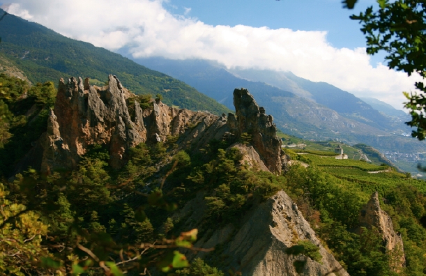
Switzerland’s Wine Country in the Valais is filled with terraced grapevines, old church spires, and medieval castles. ©Laurel Kallenbach

This magical footpath winds through vineyards for 6.5 km (about 4 miles) and offers exquisite views of the Valais’ Rhone Valley. (You can return by train to your point of departure.)

Open all year, this relatively easy (and educational!) trek links the wine museums in the village of Salgesch (Salquenen is its French name) and in the town of Sierre.

At times the views along the Wine Trail are quite wild. © Laurel Kallenbach

Along the route are signs explaining the history of this Swiss wine region and the different kinds of grapes that grow there. (Alas, these signs are in French and German only. Brush up on your linguistic skills before you go!). There are also strategically located picnic spots and benches along the way.

I hiked the trail from scenic Salgesch to Sierre, and here’s a tip for people with limited time: If you can’t do the whole trail, walk at least 10 minutes up the road from the Salgesch wine museum for spectacular views of the town’s church tower with the mountains in the background.

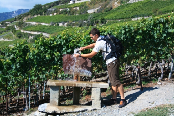
If you get thirsty while hiking, you can refill your water bottle at a pump along the this scenic Swiss trail. © Laurel Kallenbach

Strolling Among Grapevines

At first, the road and then gravel or dirt trail leads steeply to the vineyards, then it follows the contours of the terrain and crosses the Raspille River, the demarcation line between the German- and French-speaking parts of this region. It then follows some ancient bisses (ancient irrigation canals), all the while opening up new and glorious vistas.

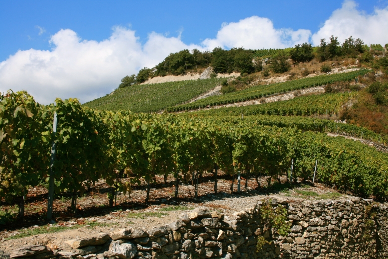
Vineyards in Valais, Switzerland  ©Laurel Kallenbach

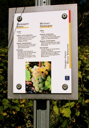
There’s one spot along the trail with signs labeling the various types of grapes—many of which I had never heard of, but which I later learned make excellent wines, including Cornalin, Petite Arvine and Humagne Blanche.

Signs explaining the characteristics of different grapes grown in the Valais. ©Laurel Kallenbach

Later, you pass through the village of Muraz where there’s a good restaurant if you want a meal or a glass of wine. Then, continue on to the town of Sierre, where the trail ends at another wine museum. Just a block away is the Château de Villa, a restaurant that specializes in raclette, a Swiss melted-cheese specialty.

The Château de Villa also has an extensive wine cellar and tasting room devoted to the vintages of the 400 winemakers in the Valais. You could wander for an hour or more inspecting its many bottles—and hopefully sampling a few.

Marche des Cépages

I want to mention an annual wine event that takes place in early September and centers on the Wine Trail. It’s called the Marche des Cépages (which translates roughly into “walking through different types of grapes”) and it attracts thousands of people who pay a fee to get a tasting wine glass. They then walk along the trail with their glass, stopping at tents along the way to sample wines from the very vineyards they’re wandering through.

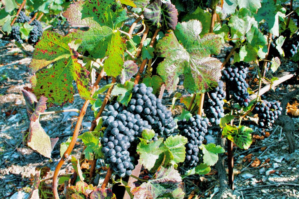
In mid-September, the grapes were heavy on the vine in the Salgesch/Sierre wine country.      ©Laurel Kallenbach

I was a week too late to do the Marche, but it sounds like a blast—especially after you’ve drunk a glass or two of wine. In fact, on any day, I’d highly recommend you pack along a bottle as you walk the Wine Trail.

Laurel Kallenbach, freelance writer and editor

More info: Salgesch and Sierre are located in Switzerland’s Valais canton. For more info, visit MySwitzerland.com, Wines of Valais, Valais Tourism, Sierre/Salgesch Information.

Next: Eating raclette at the Chateau de Villa

Read more about my travels in Switzerland:

4 Read More

Colorado’s Crested Butte Struts Its Fall Foliage


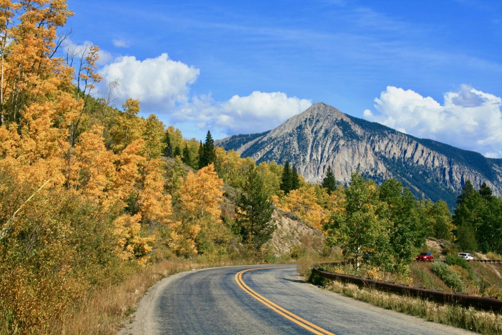
Gothic Mountain near Crested Butte: No wonder Colorado’s state colors are blue and gold. ©Laurel Kallenbach

Originally posted October 1, 2014

On the last  weekend in September, Ken and I headed up to our favorite mountain area: Crested Butte, Colorado. We’ve been there for powder days in winter and for wildflower fireworks in summer, but autumn definitely had some sizzle in store for us.

I’m usually verbose in blog posts, but this time I thought I’d let the photos do the talking. All I can say is that it’s worth the five-and-a-half-hour drive from Boulder to get to this Shangri-la of the Rockies.

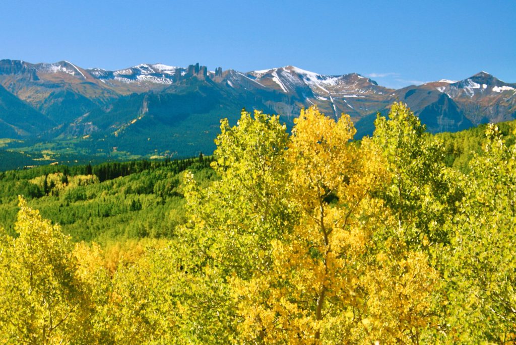
The Castle spires as seen from Ohio Creek Roadnear Crested Butte. Photo ©Laurel Kallenbach

Kebler Pass, just above Crested Butte, boasts the largest aspen grove in the state, but in most spots the aspen hadn’t yet started to change colors. There were vistas on Kebler Pass,  with more to come the first week of October, I think. With the right timing, fall is insanely gorgeous there. You can take Ohio Creek Road from Gunnison to Crested Butte. (Or, you can also get to Ohio Creek Road from Kebler Pass.) One great reward is seeing the Castle Mountains from that  road.

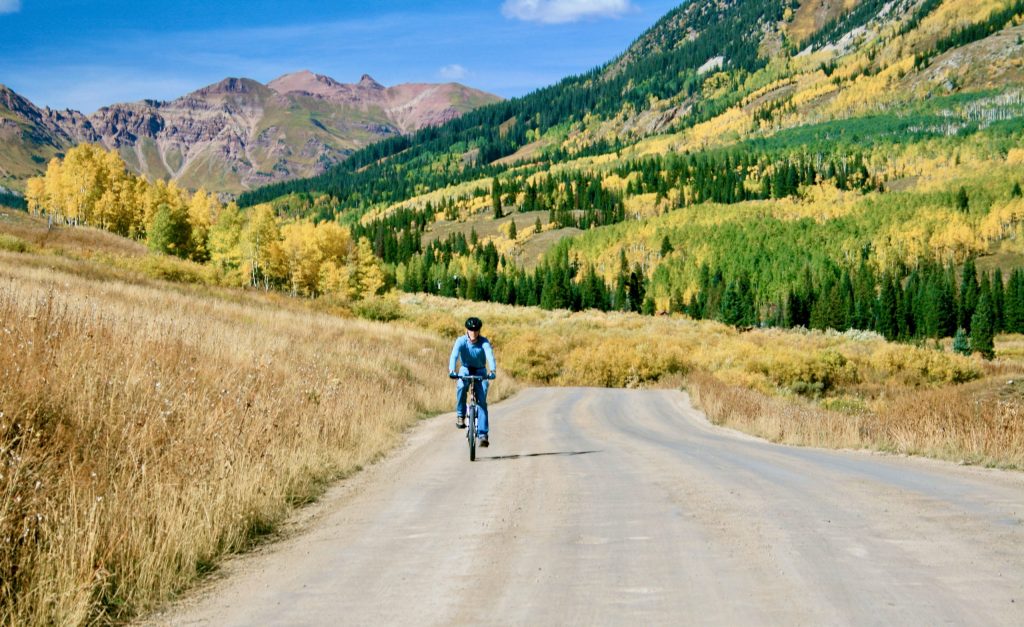
My husband, Ken, cycled along the road to Gothic, a mountain town above Crested Butte. ©Laurel Kallenbach

The road up to Gothic displayed some pretty impressive foliage. We were among the many cars that kept pulling over to the edge to snap photos. (That’s right: while leaf-peeping, it’s entirely spossible to encounter traffic jams!)

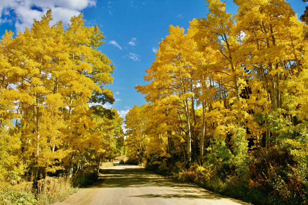
Colorful aspen trees flanking Gothic Road near Crested Butte. ©Laurel Kallenbach

For tips on scenic mountain drives around Crested Butte, visit the Gunnison–Crested Butte Tourism Association.

Laurel Kallenbach, leaf-peeper

Related posts about Crested Butte:

P.S. Leave a comment below reporting on your favorite fall scenery.[/vc_column_text][/vc_column][/vc_row]

12 Read More

Close Encounters of the Galápagos Kind

On the Galápagos Islands, you can get close to to animals and birds—but you should never touch the wildlife. Photo courtesy Ecoventura

(Originally posted in  2009)

Life on a sustainable Ecoventura cruise in the Galápagos Islands is never dull: every day our group made two shore excursions to see exotic birds, strange reptiles and amusing animals. We hiked, sea kayaked and snorkeled at a different island daily—each more lovely than the one before.

A Galápagos trip is a crash course in species that live nowhere else on the planet. I felt like I crammed a full semester of zoology, ornithology and botany into a single week. Most important, experiencing the wildlife up close and personal solidified my commitment to protecting these species. (My husband and I make an annual donation to the Galápagos Conservancy now.)

By the way, the reason Galápagos animals and birds live in harmony—with no fear of humans or each other—is there’s no competition between species. They don’t prey on each other, so when we bipeds approach, they don’t see us as a threat either.

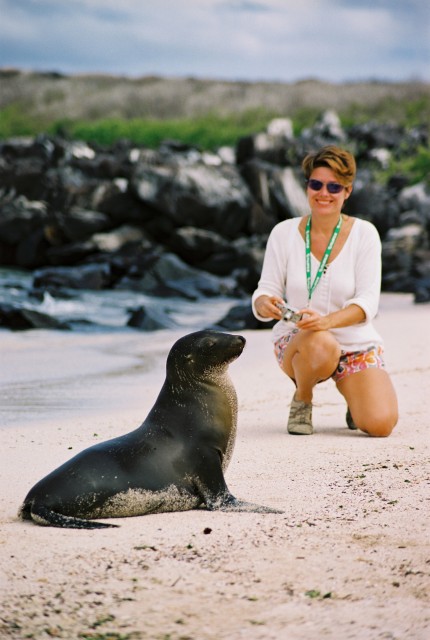
We’re taught never to touch an animal, which can be tricky. On an Española beach, a seal lion pup was so curious about us humans that we had to run away from him! Below are some of the trip’s many unforgettable  highlights.

“I Love Boobies”

In the Galápagos airport, you can’t miss the T-shirts that say “I love boobies!” above a photo of these humorous birds. When I first saw the shirts I rolled my eyes, but I have to admit that by the end of my trip I was saying: I do! I do! I do love boobies!

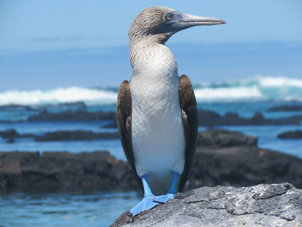
The blue-footed booby is just one of the booby varieties we saw. Photo by Peter Stuart Millig, Pixabay

We often saw both blue-footed boobies and Nazca boobies (identified by their white feathers with a large black stripe), and they’re the most charming birds.

One afternoon, at Punta Suarez on the island of Española, we watched a male blue-footed booby performing his courtship dance. He bobbed up and down. He puffed out his chest. He hopped on one bright-blue foot and then the other. The female seemed mildly interested, until he picked up a stick in his beak and presented it to her. She accepted! I think we witnessed a marriage proposal.

Sally Lightfoot Crabs and Sea Lions on Santiago Island

I loved seeing these intensely-bright red-orange crabs against the black lava rocks. It’s fascinating watching them scoop up algae with their front claws and bring it to their prehistoric crabby mouths.

Sally Lightfoot crabs are one of the many species that are unique to the Galápagos Islands. Photo: Pixabay

Their faces are laced with brilliant colors: blue, yellow and subtle striations of orange-red.Near the crabs, lava-black marine iguanas spit salt out of their dinosaur-like noses with a hiss. A little creepy, but very mesmerizing!

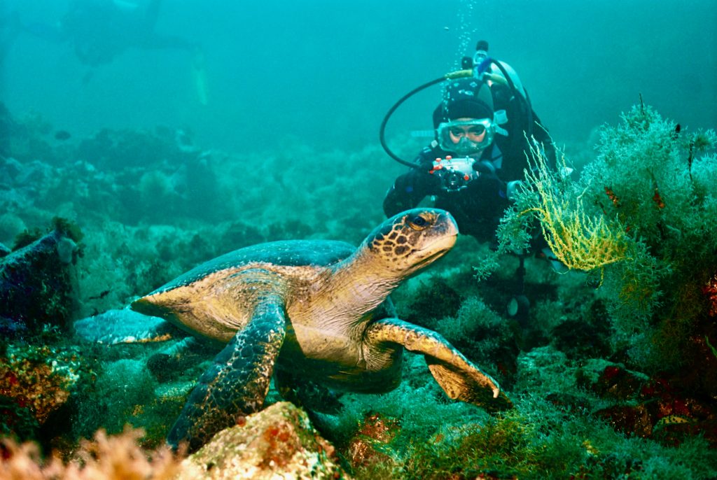
Later we snorkeled and spotted three green sea turtles, their flippers like gentle wings gliding through the water. They stopped to munch on clumps of orange and yellow sea lettuce.

A diver gets an up-close peek at a sea turtle in the Galápagos’ Pacific waters. Photo courtesy Ecoventura

Another  really big excitement was a pair of  sea lions who swam past us at high velocity as we snorkeled. The sea lions  didn’t stop to greet us, unfortunately, but it was exotic to be just an arm’s length away from them. And I felt truly at a disadvantage as we floundered through the waters while they elegantly whirled past.

The Birds of Isabella Island

As we hiked along the hardened volcanic-ash earth, we spotted the famous Darwin finches. (They were instrumental to Charles Darwin’s theory of natural selection.) Their nests look like balloons with a small opening on one side.

Our guide, Orlando, explained that the males build two or three nests and wait for females to chose one. The picky female goes from one nest to the other, inspecting the real estate, so to speak, until she finds her dream home. There she lays and incubates her eggs, while the male brings her food. After the chicks have hatched, however, Mom takes off, leaving the male to do all the rearing and to act as flight instructor. She moves on to new romance with another innovative nest architect.

Next, we got back into the panga (small boat) and found penguins swimming about. One was taking a rest from fishing, however, and posed photogenically on a rock. Orlando steered the panga just a few feet away. Mr. Penguin opened his eye to check us out, then continued his nap. Click, click, click went our cameras.

Galápagos penguins: We watched these adorable birds on land and also spotted them torpedo-ing underwater while we were snorkeling.  Photo by Sabine van der Meulen

The day’s grand finale: snorkeling off the panga. As soon as we slid into the water, cute little penguins zipped past us. At first I thought they were speedy fish, but then I noticed their white-and-black tuxedoed feathers, which shimmered with trapped oxygen bubbles. They were so cute, I laughed—which is tricky when you have a snorkel tube in your mouth.

Magazines are always advertising trips of a lifetime. Well, I’ve been a lot of places on the planet, but I can honestly say there’s no other trip like one to the Galápagos Islands. Unforgettable!

For more about the Ecoventura cruise, see my post: “Galápagos Islands: Take A Sustainable Cruise”

Laurel Kallenbach, freelance writer and editor

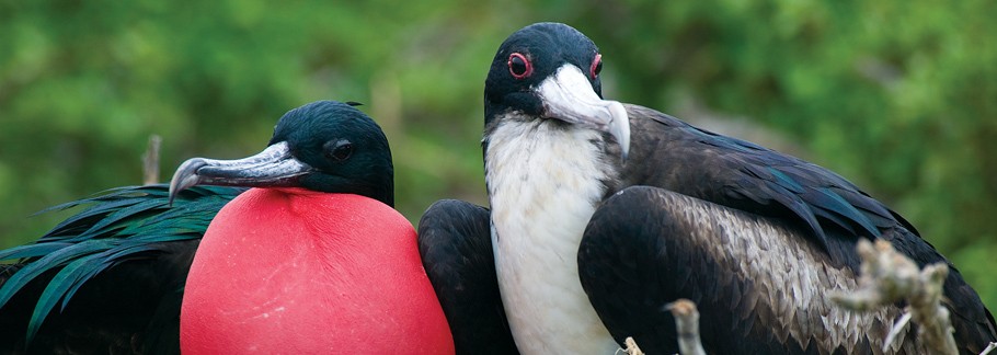
The male magnificent frigate bird has a scarlet throat pouch that inflates like a balloon in breeding season. Photo courtesy Ecoventura


5 Read More

Facing West: My Favorite Maui Sunsets

Ho’okipa Beach Park is just one location on Maui for stunning sunsets. ©Laurel Kallenbach

AUGUST 2023 WILDFIRE UPDATE: My heart goes out to the people of Maui who are impacted by the fires. Donations can be made to the Maui Strong Fund.

As the sun starts to dip toward the horizon on the island of Maui, you can sense the excitement in the air.

Tourists as well as locals plan their day around where they’ll be during the sunset with almost cultish passion. My husband and I worked most of our evening meals around sunset—it’s that exciting and awe-inspiring.

Although there are probably hundreds of spots for sunset watching on the Hawaiian Islands, here are three different locales on Maui where we enjoyed breathtaking color and dramatic cloud formations as daytime morphed into nighttime.

This is definitely island life at its best, and one of the prime reasons to travel to beaches and islands.

The Fiery Blaze

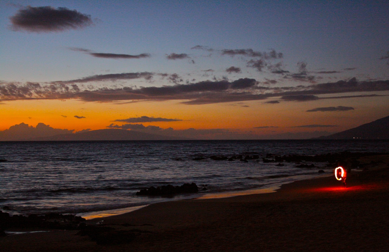
We spent four nights on west-facing Keawakapu Beach at the Hale Hui Kai beach condos, and every evening, a fire dancer arrived and twirled his lit batons as onlookers ooh-ed and ahh-ed. Upstaging him were the brilliant bands of clouds on fire as they were reflected in the water.

A fire dancer added even more local color to sunset at Keawakapu Beach, Maui ©Laurel Kallenbach

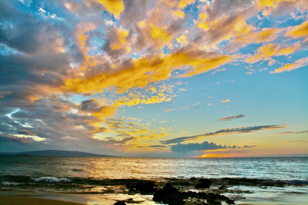
Maui’s Keawakapu Beach offers breathtaking sunsets 365 days a year.

You can’t beat Maui’s Keawakapu Beach, in south Kihei,  for sunsets. ©Laurel Kallenbach

The Serene Sunset

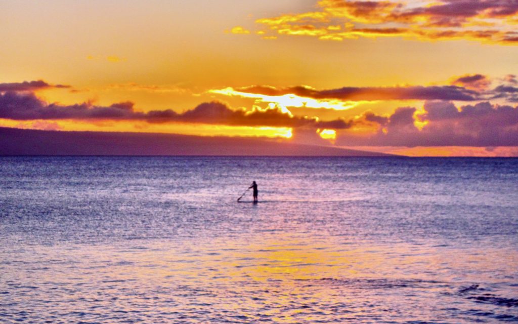
On calm Napili Bay, stand-up paddlers tended to float along as the sky lit with stunning pinks and oranges. Most of the nights we stayed at the Napili Kai Beach Resort, we marveled at the splendid sunsets from our private balcony.

A standup paddler takes advantage of the calm waters of Napili Bay on Maui. ©Laurel Kallenbach

The Big Wow

Our friend Sandy drove us to Ho’okipa Beach Park (near the cute town of Paia) just as the sun began to slip into the west. It was our last sunset: two hours later we were boarding the plane to fly home. With a cliff, dramatic lava rocks, and huge waves filled with expert surfers, Ho’okipa Beach Park was the perfect place to cap off our trip to Hawaii.

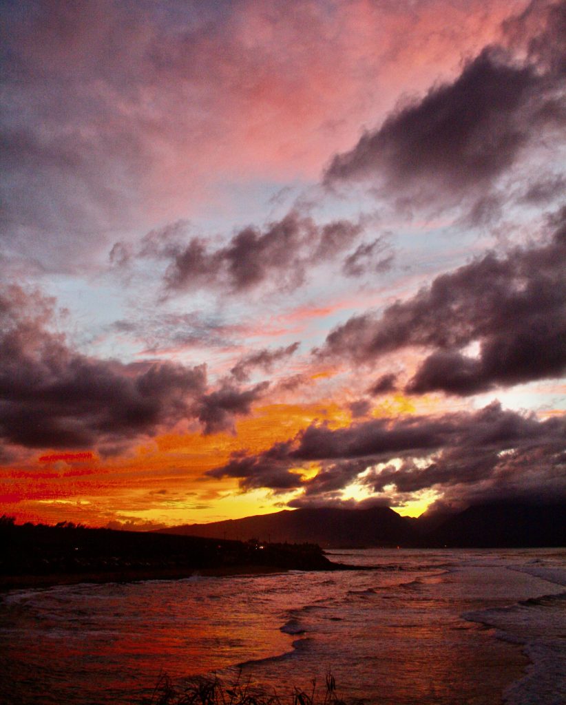
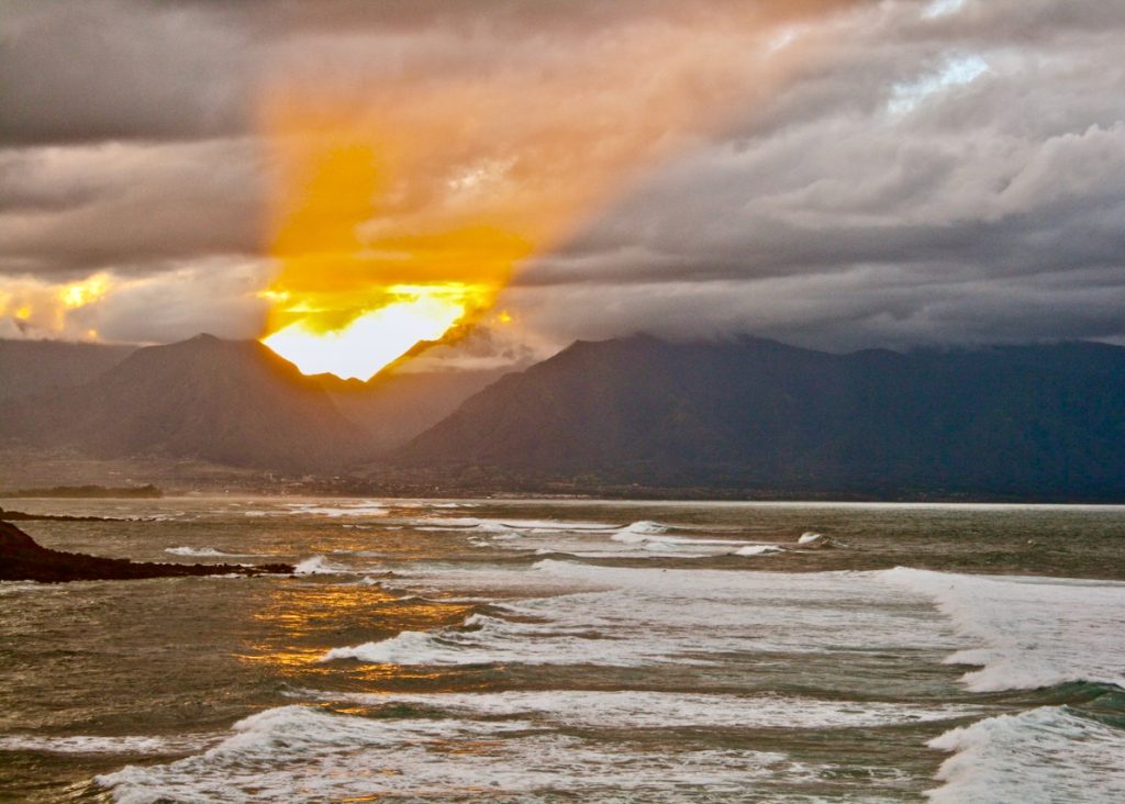
Sun rays explode through the clouds of Iao Valley. We watched this stunning sunset from Ho’okipa Beach Park on Maui. ©Laurel Kallenbach

Here, bright rays streamed through Iao Valley with biblical illumination. Then we walked down the hill to be closer to the water’s crash on the lava rocks, where we watched the sky turn pink, salmon, cantaloupe, and turquoise. The wind whipped; we could feel ocean spray on our faces. And always the light changed and grew more intense. The Ho’okipa sunset was quite a dramatic sendoff, and it sealed our resolved to visit Maui again soon.

Laurel Kallenbach, freelance writer and editor

Originally published May 2014


3 Read More

The Star-Spangled Banner Goes Solar

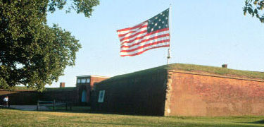
Soaring above historic Fort McHenry National Monument in Baltimore, the birthplace of the National Anthem, is a flag representing The Star-Spangled Banner. It’s pretty cool that this American icon is illuminated by solar power.

The Fort McHenry Guard fires a cannon in honor of the Star-Spangled Banner flag.

Four LED lamps draw their power from a pair of low-profile solar panels to shine the light on the landmark 30-by-42-foot flag.

The  lights save energy and money, and they better enhance the colors of the flag. Officials at Fort McHenry report that the solar lights do not intrude on the historic character of the fort, unlike the old, ground-level, incandescent floodlights.

History of the Flag

In 1814, amateur poet Francis Scott Key wrote the lyrics to “The Star-Spangled Banner” after witnessing the bombardment of Fort McHenry by the British Royal Navy ships in Chesapeake Bay. His impressions of seeing the tattered flag in “the rocket’s red glare” during the Baltimore Battle of the War of 1812 eventually became the words to America’s national anthem.

The flag flying at Fort McHenry, though symbolic, is not to be confused with the actual Star-Spangled Banner relic, which is displayed in the Smithsonian Museum in Washington, D.C.

Red, White, Blue and Green

“By using solar power, we  harness ‘the dawn’s early light’ that enabled Francis Scott Key to see the Star-Spangled Banner and use it to power the lights that allow us to view it ‘at the twilight’s last gleaming,’” said National Park Service Director Jonathan B. Jarvis. “It is just one of the many ways that we are incorporating renewable energy and sustainable practices into park operations.”

The “greening” of Fort McHenry has also included converting most of its external lighting to solar power, installing high-efficiency HVAC units and storm windows, setting up a geothermal heat-pump system, purchasing electric utility vehicles, and constructing a LEED-certified visitor education center.

The Star-Spangled Banner at Fort McHenry

July 4th celebrations at Fort McHenry include fife and drum music, cannon firing, a musket salute for 18 states, period dancing, and a public reading of the Declaration of Independence.

Laurel Kallenbach, freelance writer and editor

Photos courtesy: National Park Service

Originally published 2013

Read more about my travels in America’s national parks and monuments:

0 Read More

Art Quest Near Taos, New Mexico

Originally published September 27, 2008; updated June 2023

Last weekend I discovered an art jewel: northern New Mexico’s High Road Art Tour, an annual, late-September event. If you enjoy seeing art, meeting artists, and driving through the creativity-inspiring landscape between Taos and Santa Fe, this is a don’t-miss event.

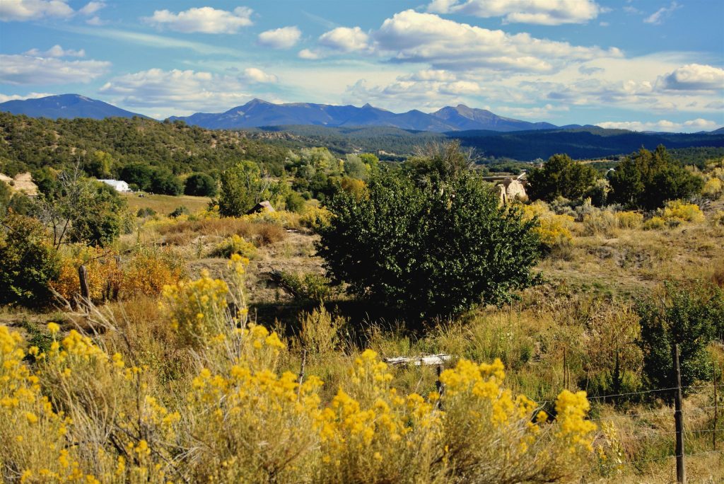
The view of the Sangre de Cristo Mountain Range and golden chamois from Enbi Studio, one of many art galleries on the annual High Road Art Tour between Santa Fe and Taos. ©Laurel Kallenbach

My husband and I and our friends Frank and Monica made our home base at La Posada de Taos—a charming B&B in a hundred-year-old adobe house that’s just two blocks from the Taos Plaza. The new owners, innskeeper Brad Malone and chef Michael Carter have created a lovely ambiance and fantastic gourmet breakfasts. The historic house itself has an arts connection: It was built in 1906 by Burt Phillips, one of the founders of the Taos Society of Artists.

On the Art Road

Feeling like a cross between art pilgrims and treasure hunters, the four of us piled in the car with our High Road Artisans map in hand and drove through the mountain villages of northern New Mexico on the High Road (which links Taos and Santa Fe).

As we wound through picturesque roads lined by golden-blooming rabbitbrush (chamisa) we encountered weavers, photographers, painters, potters, sculptors, jewelry-makers and woodworkers whose studios are located all along the High Road.

One stop on the High Road Art Tour is Garcia Spanish Colonial  Arts Studio. Lorrie Garcia’s retablos and bultos are renouned.  ©Laurel Kallenbach

I love glimpsing the studios of world-class artisans, many of whom open their doors to the public only once a year during this art tour. I also love that the High Road Art Tour organizers are dedicated to preserving and developing local talent and traditions in these remote, northern New Mexico villages.

On our journey, we stumbled across an intense mix of interesting artisans and kooky characters—all passionately devoted to making art. Here are just a few of the many we saw:

Andrew Garcia carves intricate furniture from local wood. ©Laurel Kallenbach

Andrew and Lorrie Garcia: We expended plenty of oohs and aahs on Andrew’s exquisitely carved Spanish Colonial furniture and Lorrie’s authentic-looking traditional retablos (devotional paintings) and bultos (wooden sculptures of saints and religious figures). Andrew mills wood off the couple’s property. Garcia Colonial Arts studio in Peñasco, New Mexico.
Buffalo Ranch Studio: Located on an actual buffalo ranch near the Picuris Pueblo, Harriette Tsosie works in acrylic and encaustic (pigmented wax). We watched her melt the wax on a new painting using a blow-torch! Who knew making art could be so dramatic!
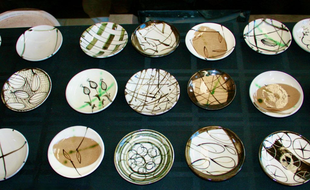
Enbi Studio: Potter Betsy Williams specializes in wheel-thrown bowls, influenced by her apprenticeship in Japan. Betsy’s Dixon, N.M., studio gets the blue ribbon for gorgeous views. This accomplished ceramicist has a quiet dignity about her, and she draws inspiration from the nature around her studio. In fact, the views from her land are magnificent, especially on the sunny, autumn day when the light reflects off the wildly yellow blooms of the chamisa (rabbitbrush) in contrast with the glorious blues in the endless sky, the white clouds, and the purple hues of the Sangre de Cristo mountains to the west. It’s almost as if the landscape itself plays the muse for Dixon—and for all the other artists in the region—past and present. Georgia O’Keeffe was one of the greats from the past who drank from northern New Mexico’s well of inspiration.

Potter Betsy Williams paints each of her tiny, Japanese-inspired, wood-fired plates in a different and original pattern. ©Laurel Kallenbach

Studio Gallery: We wandered for almost an hour through David Cudney’s sculpture garden and outdoor installation-art display. David has spent six years creating weird, riveting, surreal art from junk, which is spread out over a couple of acres off State Road 76 near Chamisal. A few of the wacky highlights include: a paint-bucket waterfall, steel-girder dinosaurs with cow-skull heads, a totem pole made with rusty chamber pots and enamel basins, Michelangelo’s “David” in an aquarium.

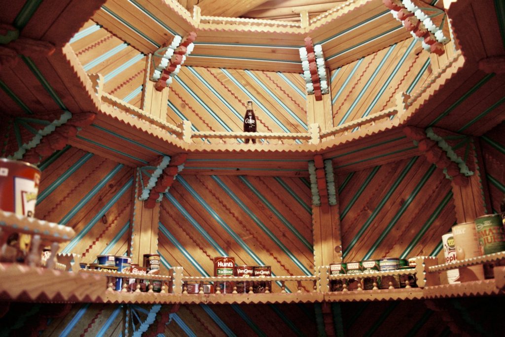
Isabro Ortega: When we visited in 2008, visionary wood artist Isabro Ortega was carving nearly every wooden surface of his work-in-progress home in Truchas into the New Mexican version of the Taj Mahal. He called himself crazy, and no wonder: He had already s spent 24 years carving nooks, window frames, a home chapel, ceilings, and the most ornate pantry (yes, pantry!) I’ve ever seen. (See the photo!) Isabro was a hoot, and he had overcome alcoholism and was pouring his talent into woodworking. My friends and I hoped it won’t take 24 more years to finish his house, which though a bit chaotic,  was exquisite. (Postscript: Isabro Ortega passed away in 2018; his Casa was not finished.)

A well-carved pantry: Isabro Ortega lavished years of craftsmanship on in his Truchas home. No one else’s food has ever been stored amid such artistry. ©Laurel Kallenbach

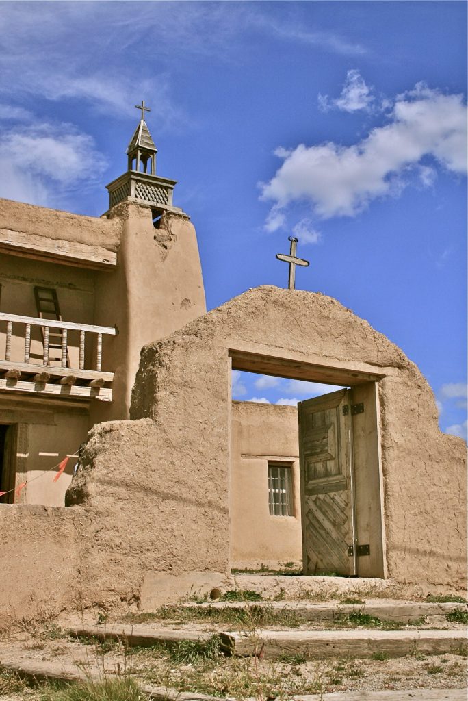
We spent a full day of stopping here and there along the High Road between Taos and Santa Fe, looking at the work of so many different types of artists.  Along the way, we also went into the  lovely adobe   San José de Gracia Church, built in 1760. The church at the time was undergoing some renovation, but it was another form of human-created beauty.

Sadly, the High Road art Tour is over—for this year. I’m marking my calendar for next September.

Laurel Kallenbach, freelance writer and editor

San José de Gracia Church, also known as Church of Santo Tomas Del Rio de Las Trampas. It’s located In Trampas, New Mexico. © Laurel Kallenbach

0 Read More

Sleep in the Straw in Switzerland

Originally posted in July 2013

When I travel, I’m always on the lookout for unique and independently owned places to stay that will benefit the local economy. Switzerland offers a sustainable, economical, family-friendly bed-and-breakfast experience I’ll never forget: sleeping in the straw on a farm.

Spending the night in a Swiss barn is fun and adventurous. Photo courtesy Schiltenhof Schlafen Im Stroh Villa in Iseltwald, Switzeland. https://schiltenhof-schlafen-im-stroh-hotel-iseltwald.booked.net

Switzerland’s Sleep in Straw association—called Schlaf im Stroh in German—consists of 150 Swiss farms and helps travelers easily connect with the hayloft of their choice.

Bed in a Barn

At Bruffhof Farm in Switzerland’s cheese-making Emmental region, the sound of cowbells and mooing woke me at dawn. I sat up in my sleeping bag, shook the straw from my hair, and looked around the hayloft to see if my friends were up. (Bruffhof Farm no longer operates as a sleep-in-straw; it is now an animal sanctuary.) You can find listings of other sleep-in-staw locations on the Switzerland Tourism website.

Bruffhof is just one of Switzerland’s Sleep-in-Straw network in which visitors bed down in the barn—not with the animals, but sometimes in an adjacent area. (At most farms, restrooms and showers are located in separate buildings.)

Guests can volunteer, if they like, to help out with farm chores: collecting eggs, picking vegetables, helping milk cows. The side effects: plenty of fresh air, a lot of fun (provided your loft-mates don’t snore too loudly), and a better understanding and appreciation about where your food comes from and the hard work that farmers do.

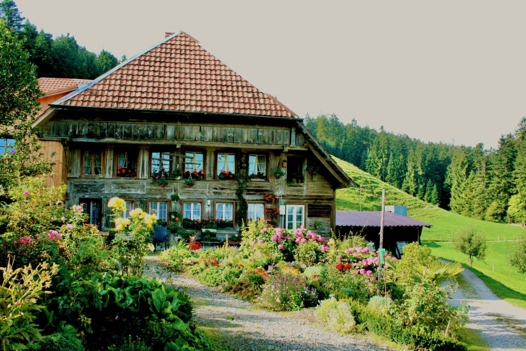
Bruffhof Farm, in Switzerland’s Emmenthal region, was flowering and beautiful when I visited in 2010. Photo © Laurel Kallenbach

My breakfast at Bruffhof was heavenly, with homemade bread, jam, and muesli. The cheese, yogurt, butter and honey were from the farm’s own cows and bees. “Families stay here so their children learn where food comes from,” said farmer Franz Schwarz (who spoke just a little English).

Bruffhof Farm grows organic herbs—many for the Ricola cough-drop company, based in Switzerland. The rest of the farm is certified as “Integrated Production,” a Swiss designation that allows only minimal pesticide/herbicide use. Farmer Franz and his equally hard-working wife, Rita, also raise goats and dairy cows.

How well did I sleep in the straw? Pretty well, actually. The fresh, sweet-scented hay was soft, and I managed to arrange it beneath me in a relatively comfy contour.

How Farmhouse B&Bs Work

At a Sleep-in-Straw farm, there’s always the possibility you’ll be sharing the hayloft with strangers. I traveled with a group in late September, so we had the entire sleeping area to ourselves, but if you’re traveling singly, as a couple, or with a small family in the busy summer, you’re likely to get to get acquainted with fellow snoozers from all over the world.

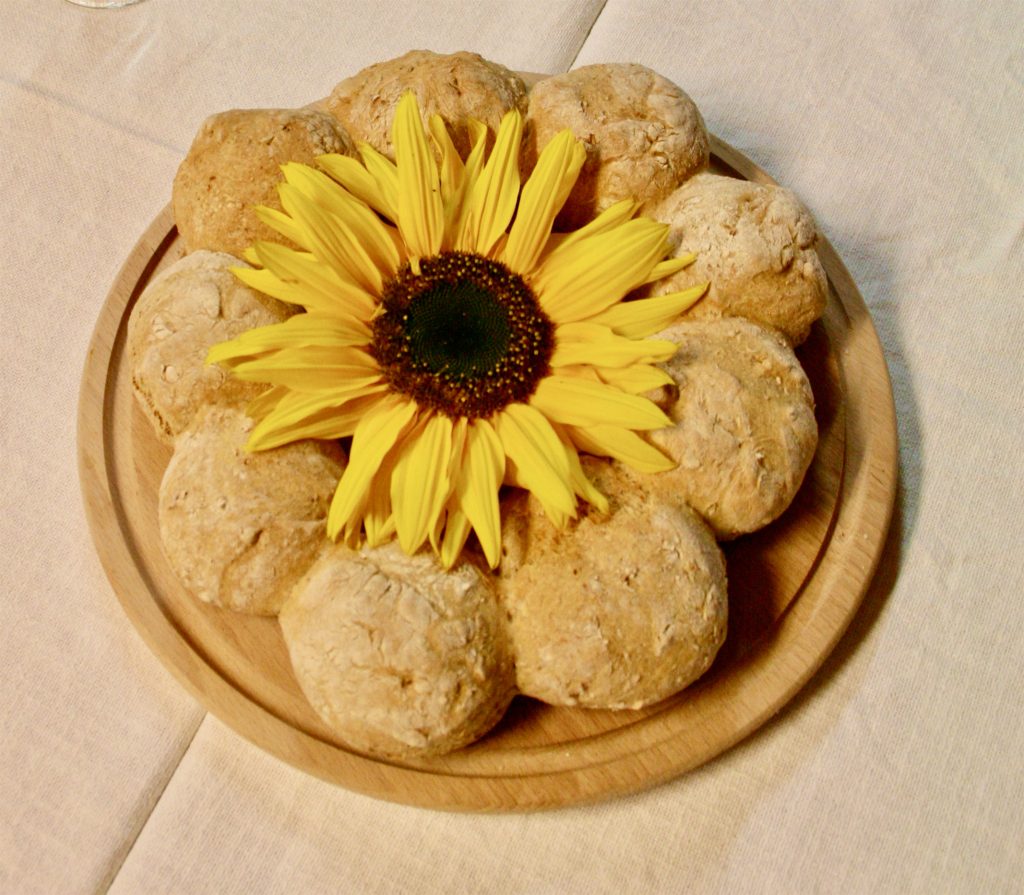
Among the many options at breakfast were fresh-baked farm rolls. The food at Bruffhof was hearty and outstanding. Photo © Laurel Kallenbach

To make reservations, you choose a farm in the region of your choice and book your “sleep in straw” experience directly with the host family—they’re the ones who benefit from the fee.

(These days, running a family farm requires entrepreneurial ingenuity, and the farm owners truly need the extra income generated from this B&B program. One of the joys of staying on a farm is that you’re experiencing a different place in an authentic way—and your money goes to a great cause: the continuation of small-scale, responsible agriculture.)

It’s best to book in advance. You bring your own sleeping bag or pay a bit extra to use one of  the farm’s. Blankets are provided by the hosts. Many of them also offer pillows; if not you can always bunch up straw inside a blanket for that purpose as well.

The Details

  • Sleep in Straw: The per night fee is economical and includes breakfast. Some Sleep in Straw farms offer other amenities (such as dinners and even beds in bunkhouses) for an extra fee.
  • If you’re not comfortable communicating in German, French, or Italian (Switzerland’s three national languages) be sure to find a farm with English speakers. At Bruffhof, where the family was German speaking, it was easy communicating with hand signals, and one of the Schwarz daughters was a excellent student of English at school.
  • Many Sleep-in-Straw farms are accessible by bicycle. Eurotrek rents bikes, maps out self-guided routes for you, and organizes daily luggage transfers between accommo-dations, including farm-stays.
  • For more information: Schlaf im Stroh (click “Catalog” for downloadable, multilingual information on the farms).

Laurel Kallenbach, freelance travel writer and editor

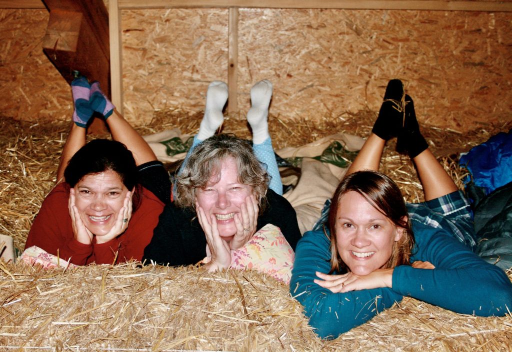
My friends and I felt like little kids at a “lofty” sleepover! © Ursula Beamish

Updated July 2022

Read more about my travels in Switzerland:


13 Read More

Earthships: Recycled Houses Made of Dirt

Just 15 minutes outside of  Taos is the world’s Earthship headquarters—and my New Mexico trip just wasn’t complete without a quick look at these beautiful, fascinating, and environmentally responsible houses.

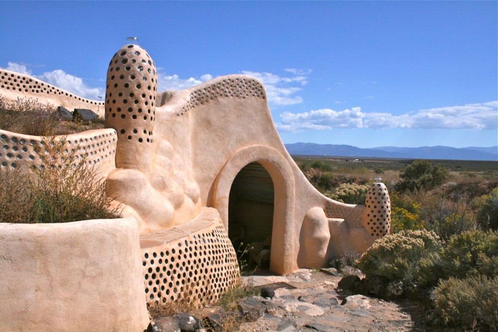
A unique and eco friendly earthship near Taos, New Mexico © Laurel Kallenbach

An artistic and eco-friendly earthship located near Taos, New Mexico © Laurel Kallenbach

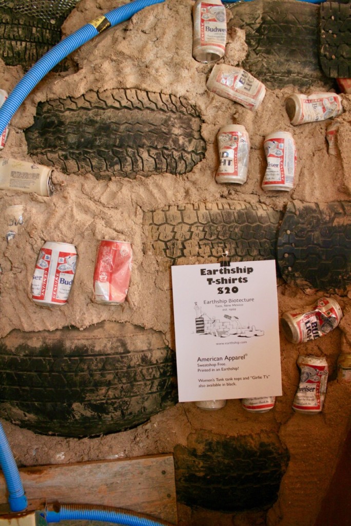
What, exactly, is an Earthship? It’s an off-the-grid and self-sufficient home built from recycled tires, aluminum cans and bottles packed with dirt, then plastered over with natural mud. [See the photo below.] That’s right: no brick and mortar, no wooden studs. Just junk and soil. In fact, one of these buildings diverts 500 to 5,000 tires away from the landfill. Because Earthships are banked into the earth—with a southern exposure for maximum sunlight—they’re extremely energy efficient. Their earthen properties keep them cool in summer and warm in winter.

According to Earthship Biotecture, which builds the structures, “Earthships harvest water from the sky and recycle that water multiple times. They grow their own food, treat their own sewage, and collect power from the sun and wind. They also use passive solar heating and cooling. Imagine no utility bills and a home that takes care of you year round.”

A peek at what's inside the walls of an earthship © Laurel Kallenbach

A peek at what’s inside the walls of an earthship: old tires, beer cans, and mud. © Laurel Kallenbach

Earthships are designed with all the rooms open along a corridor with a huge bank of windows. This way, natural daylight eliminates the need for electrical lighting as long as the sun shines.

A lot of these New-Age structures on the sage- and rabbitbrush-covered land around Taos, New Mexico, are equipped with solar panels or small wind turbines to create electricity from these renewable resources. Needless to say, this is critical for lowering our dependence on fossil fuels and cutting global levels of carbon emissions.

Outside of Taos, there are dozens of Earthships dotting the northern New Mexico landscape with its dramatic views of the Sangre de Cristo mountains. Clearly, this form of architecture—sometimes called “biotecture”—is environmentally important.

Water Harvesting

New Mexico is dry, deserts environment, and with the Colorado River at all-time, drought-level  lows, water conservation is absolutely critical. Here’s yet another advantage to Earthships: their roofs catch water from rain and snow melt. That water is then filtered and used for drinking or bathing. After you take a shower, wash the dishes or do the laundry, the used water is recycled, filtered again, and then pumped to the surrounding gardens. (The used water is called “graywater” and is suitable for watering plants but not for drinking.)

After we browsed the Visitor Center near Taos, My husband and I were really impressed by Earthships. They’re  unconventional and beautiful creations, although we were a bit skeptical about the used tires that are often used in the construction. Ww wondered: wouldn’t the tires outgas petroleum-based rubber fumes into the air? However, because they’re surrounded by thick layers of dirt and mud, it’s possible that the earth itself absorbs any toxins.

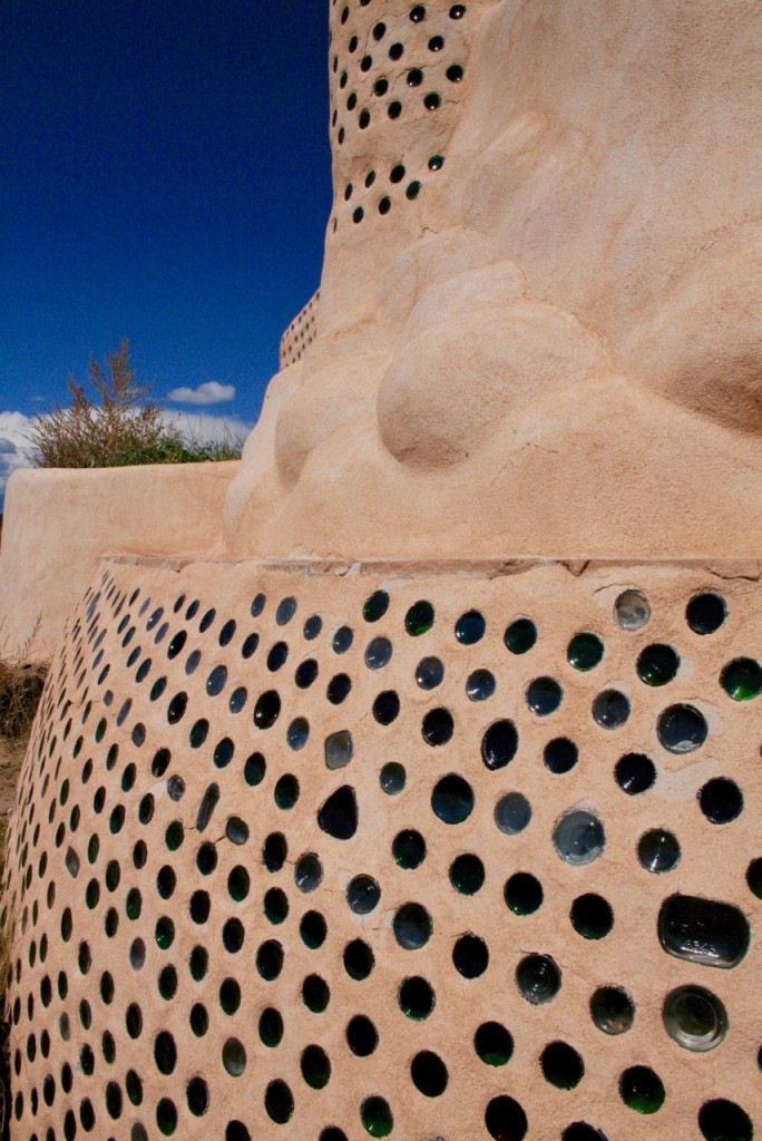
Here you can see the bottoms of glass bottles embedded into an earthship in a decorative pattern © Laurel Kallenbach.

The bottoms of glass bottles are embedded into an earthship. © Laurel Kallenbach.

To many people, Earthships look like houses on Mars. Over breakfast at our B&B, La Posada de Taos, a woman described them as “weird, but fascinating.”

“They’re actually built into the dirt!” the woman added with a shudder. I suppose Earthships are an acquired taste, but in a time when global warming threatens Planet Earth, Earthships can help us lower our carbon footprint.

Curious ro learn more about Earthship buildings? If you’re in northern New Mexico, slap on some sunscreen and stop by the Earthship Visitor’s Center (located on U.S. Highway 64, west of Taos.)

At the Earthship Biotecture Visitor Center, you’ll see displays that explain the details of Earthship technology, along with information about other ways they help help conserve natural resources.  You may choose between a self-guided visit through the center ($8 per adult) or a guided tour that includes several of the area’s demo buildings ($20).In addition, you can also spend the night in an Earthship—something I’d love to do the next time I visit Taos.

Laurel Kallenbach, freelance writer and editor / Originally posted: September 2008. Updated: May 2023


5 Read More

Discover Painted Hand Pueblo: Canyons of the Ancients National Monument

(originally published October 2008; revised May 2023)

If you’re visiting the Four Corners region—where the Colorado, Utah, Arizona, and New Mexico state lines converge—you’ll be enchanted by breath-taking Southwestern  landscapes and world-class archaeological sites that are unlike anything you’ll see anyplace else on the planet. This region, sometimes called Mesa Verde Country, encompasses Mesa Verde National Park, Canyons of the Ancients National MonumentHovenweep National Monument, and Ute Mountain Tribal Park.

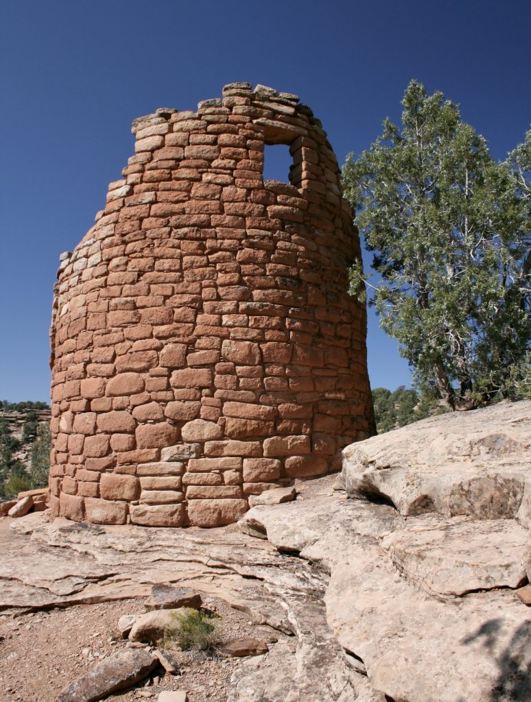
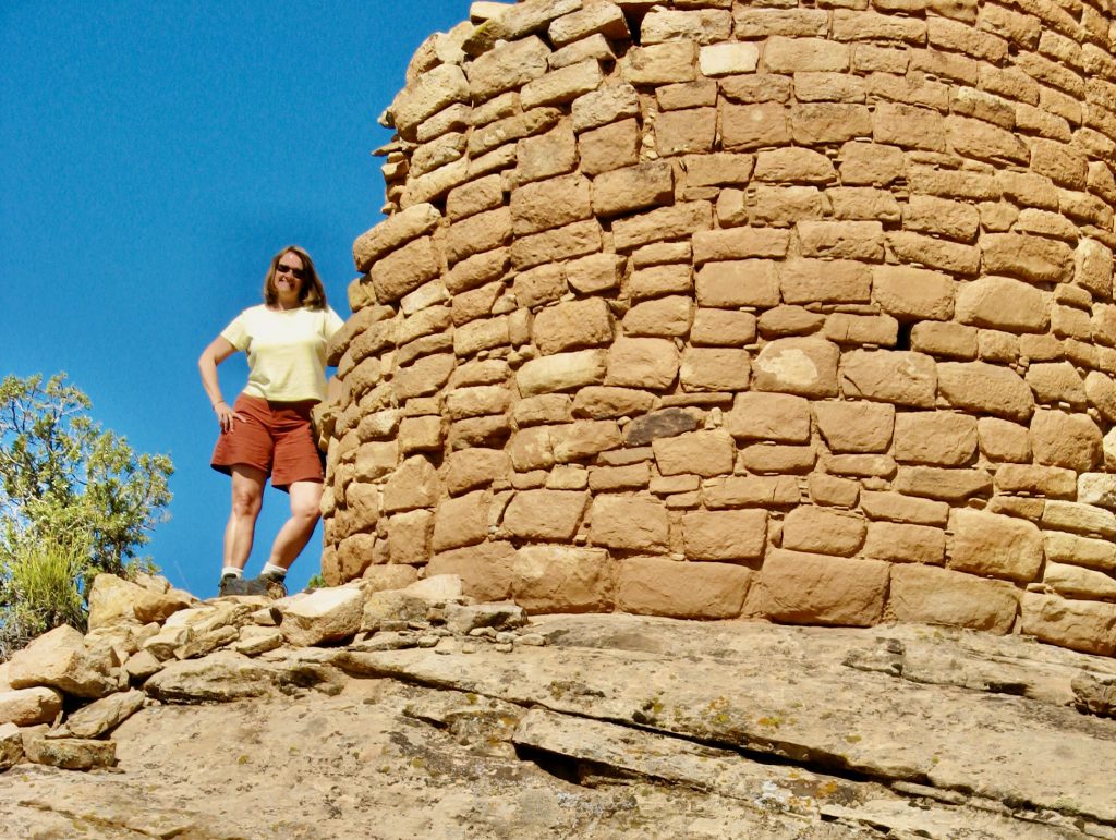
The tower structure at Painted Hand Pueblo in Canyons of the Ancients National Monument ©Laurel Kallenbach

All three of these nationally protected areas are dotted with what remains of 800-year-old structures and cities of the ancient Ancestral Puebloans, the people who settled in the area between 500 and 1300 CE.  Their civilization developed sophisticated communities that included stone towers, pit houses, living and food storage areas, and kivas (circular, underground spaces used for public meetings and ceremonies).

SERENITY AT  PAINTED HAND PUEBLO

One such site is Painted Hand Pueblo, located within the 174,000 acres of Canyons of the Ancients National Monument in southwestern Colorado, very close to the Utah state line. (It’s off Colorado Road 10, 44 miles from the town of Cortez, where there are hotels and motels. As you drive through the area to reach Painted Hand Pueblo, you’ll encounter other places to stop along the way, including Lowry Pueblo. Painted Hand Pueblo is just nine miles northeast of Hovenweep National Monument, another enchanting location to see prehistoric ruins in the Four Corners area.

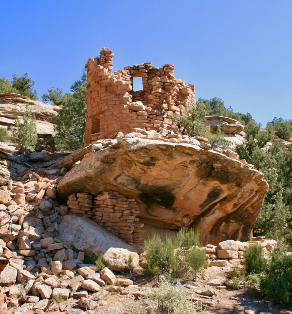
Painted Hand Pueblo is a lovely, 13th-century Ancestral Puebloan guard tower gracefully perched atop a mesa overlooking a scenic canyon where there was once a village of about 20 living spaces. You can see it from afar at an overlook, which generates excitement for the short trail to the site. The hike is stunning and not difficult; it leads through piñon and junipers.

On the warm day in 2008 when my husband, Ken, and I visited, the scent of pine sap in the sun was like enticing honey. We turned a bend in the trail, and there sat this gorgeous tower structure expertly built of stacked stones 800-plus years ago like a sentry on the landscape. (The structure was refortified by 20th-century archaeologists).

Underneath the rocky overhang of Painted Hand Pueblo is the faint, painted outline of a hand that gave this ruin its name. Here you can see the tower on top, a stone shelf, and the underpinning below. ©Laurel Kallenbach

Gazing out over the canyon, we watched a hawk circle in the ultra-blue sky and tried to make out where the village’s housing units might be. (The small structures below the rim of the canyon have only been minimally excavated, and aren’t really visible—at least not from a distance.)

At the ruin, we had to scramble and skid down a pebbled, eroded, nearly nonexistent section of the trail in order to get to the base of the tower, where we had an upward view of the structure. [Note: I imagine this part of the trail has been modified or blocked off since our 2008 trip—for the purpose of safeguarding visitors and protecting the fragile, high-desert environment from further human-caused erosion.]

It was from this lower viewpoint of the tower that  Ken found and pointed out the faint shape of three white hands on rock—the reason for the village’s name. The lonely call of a hawk overhead got me wondering about the long-ago artist who created her or his  handprint on this massive stone overlooking the peaceful valley. What was the artist’s life like? One thing I’m sure of: they would have been as awed by the scenery as we were.

WHO BUILT PAINTED HAND PUEBLO?

In Canyons of the Ancients National Monument alone there are about 8,500 structures built by the Ancestral Puebloans that have been identified so far—though it’s likely there are more that have yet to be discovered.  Only a few of the ancient pueblos (Spanish for “villages”) have been reconstructed by archaeologists—and they’re truly a wonder to behold. In fact, I first visited Mesa Verde when I was five years old, and my fascination with the remains of the civilization grabbed my imagination. I immediately decided I wanted to become an archaeologist. (Okay, I didn’t pursue that career, but as a journalist, I can write about archaeology!)

The Ancestral Puebloans lived in the Four Corners region starting as early as 500 CE, and they stayed until 1100 to 1300 CE, when they began migrating out of the region.  They were the forebears of the current-day Pueblo people, whose sovereign nations are now located in an arc stretching from the Hopi villages in Arizona to the Pueblos along the upper Rio Grande in New Mexico. These people are represented by the Pueblos of Acoma, Cochiti, Isleta, Jemez, Laguna, Nambe, Picuris, Pojoaque, Sandia, San Felipe, San Ildefonso, Ohkay Owingeh, Santa Ana, Santa Clara, Santo Domingo, Taos, Tesuque, Zia, Zuni and the The Hopi Tribe.

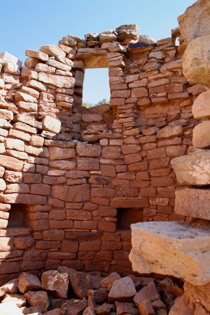
A view of the masonry from the inside the tower structure. Photo © Laurel Kallenbach

“ANASAZI” VERSUS “ANCESTRAL PUEBLOAN”

Back when I was a kid exploring Mesa Verde National Park, the Ancestral Pueblo people were referred to as Anasazi. Contemporary Puebloan people object to the use of this term, which is why we now use Ancestral Puebloan. The website for the Indian Pueblo Cultural Center explains why: “The term ‘Anasazi’ was established in 1927 through the archaeological Pecos Classification system, referring to the Ancestral Pueblo people who spanned the present-day Four Corners region of the United States, including Mesa Verde, Chaco Canyon, Canyon De Chelly, and Aztec. The term is Navajo in origin and means “ancient enemy.” The Pueblo peoples of New Mexico understandably do not wish to refer to their ancestors in such a disrespectful manner, so the appropriate term to use is ‘Ancestral Pueblo’ or ‘Ancestral Puebloan.’”

The Pueblo Cultural Center website adds: “At one time, the Pueblo homeland reached into what is now Colorado and Arizona, where incredible dwellings and trading centers were established at sites such as Chaco Canyon in northwestern New Mexico and Mesa Verde in southwestern Colorado. Pueblo people have preserved their identity in the face of multiple colonizing nations, and today, as always, they value their identity and traditional ways of life. At the same time, Pueblo people live in modern houses, working and living both on and off our reservations.”

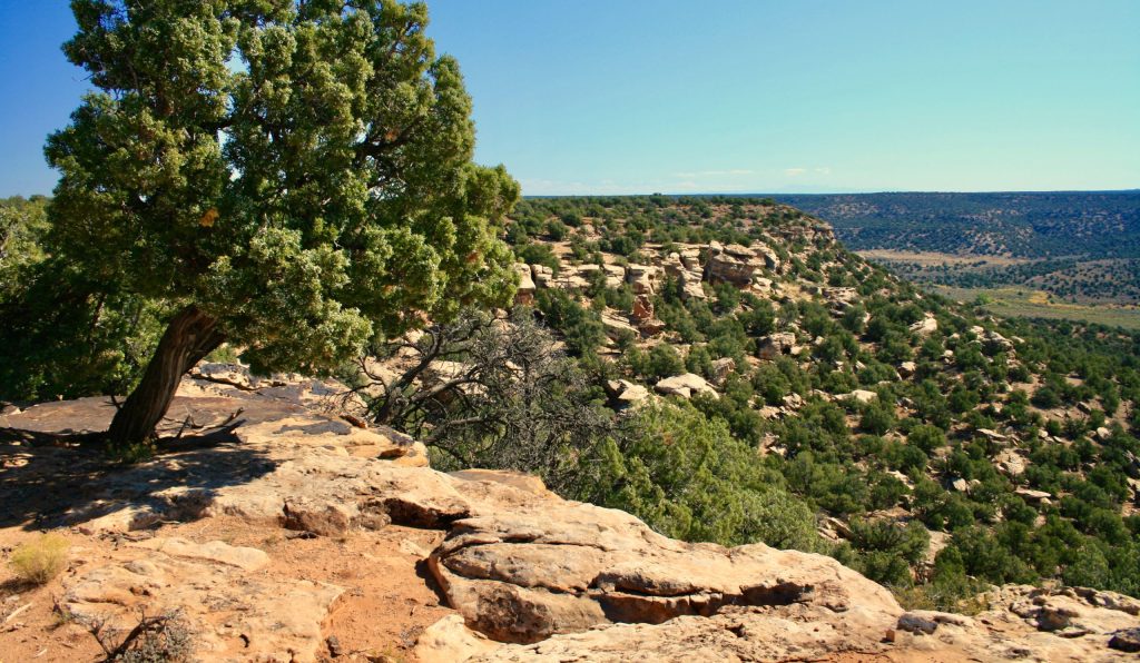
The high desert and canyon landscapes surround Painted Hand Pueblo. ©Laurel Kallenbach

“Pueblo beliefs and actions are still guided by Pueblo core values, which include love, respect, compassion, faith, understanding, spirituality, balance, peace, and empathy. Celebrations and ceremonies are continued throughout the year, maintaining the connection to Pueblo communities, ancestors, and to the Earth.”

Though archaeologists used the term “Anasazi” to identify the people of the Four Corners Region, it is a pejorative word. The Indian Pueblo Cultural Center explains.

IMPROVEMENTS AT PAINTED HAND PUEBLO: 2023 UPDATE

In 2008, When Ken and I visited, the turn-off to Painted Hand Pueblo was difficult to find, and we had to drive over a very bumpy road. We pulled over when the road started to look like more than our Toyota Camry could handle, then we hiked in the rest of the way. We’d been forewarned to carry plenty of drinking water and that there were no bathroom facilities between Lowry Pueblo and Hovenweep.

Well, no more of that travail—or of peeing in the woods! An improved road leading into Painted Hand Pueblo was completed in the spring of 2023, and the parking lot has been upgraded to provide additional vehicle parking, plus space for oversized rigs. Picnic tables and shade structures were added—and now there’s a bathroom!

Also, the short trail from the parking area to the ruin has been adjusted from a loop configuration to an out-and-back trail that protects the site and reduces erosion and environmental damage, creating sustainable visitation so that people will continue to visit Painted Hand Pueblo in the future.

ABOUT CANYONS OF THE ANCIENTS NATIONAL MONUMENT

Declared a National Monument in 2000, Canyons of the Ancients contains some of the most scenic and archaeologically important land in the American Southwest. This unique, federally protected area—176,056 acres—contains the highest known density of archaeological sites in the United States. More than 6,000 ancient sites including cliff dwellings, kivas, and rock art have been identified.

For more information on the region, visit Mesa Verde Country visitor information bureau.

PS: I highly recommend Mesa Verde Country’s Trail of the Ancients 6-Day Itinerary to delve into all the culture and landscapes of the area, including the Ute Mountain Tribal Park and Crow Canyon Archaeological Center:

PPS: If you’ve been to Painted Hand Pueblo since its road and facilities have improved, please share your experience in the Comments section below. I’d love an update.

Laurel Kallenbach, freelance writer and editor

Standing amid pre-history: I’m feeling somewhat insignificant beside this enduring structure,  estimated to have been built in 1200 CE. © Ken Aikin


Read more about my travels in America’s national parks and monuments:

4 Read More